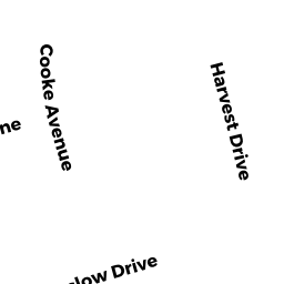
16 COOKE AV
Owner Information
KAFRAWY ADEL &
16 COOKE AV
KINGSTON,, MA 02364


Property Details
16 COOKE AV is classified as a Single Family Residential (Colonial).
The primary structure on this property was built in 1991. There are 6,551ft2 of built area within this property. There is 3,354ft2 of residential/living space within this property.
16 COOKE AV is valued at $620,500. The land is valued at $201,400 and the structures are valued at $413,200. There is an additional valuation of $5,900 on this property.
The most recent deed for 16 COOKE AV is recorded at the local registrar in Book 11011, Page 0159. 16 COOKE AV was last sold on Friday, May 29, 1992 for $265,620.
Assessment data from fiscal year 2021.
Flood Data
According to the FEMA National Flood Hazard Layer, this property does not appear to be in a flood zone. It may also be in an area not yet reviewed. Nonetheless, confirm this information prior to taking any action.
To view the flood hazards around this property, create a FEMA "Firmette" Map of the area around 16 COOKE AV.
Broadband Internet Providers
| Provider | Type | Bandwidth (mbps) | |
|---|---|---|---|
| GCI Communication Corp. | Satellite | 0 | 0 |
| Comcast | Cable | 1000 | 35 |
| Verizon New England Inc. | Fiber | 940 | 880 |
| Verizon New England Inc. | DSL | 5 | 0 |
| Viasat Inc | Satellite | 100 | 3 |
| VSAT Systems, LLC. | Satellite | 2 | 1 |
| HughesNet | Satellite | 25 | 3 |
Broadband service provider data from December 2020.
Adjacent Properties
- 20 COOKE AV
Single Family Residential owned by HARTMAN NICHOLAS G - 8 COOKE AV
Single Family Residential owned by ANGELEY CATHY A & SHIRLEY A - 7 HARVEST DR
Single Family Residential owned by ELWOOD FRANCIS & ELLEN M - 11 HARVEST DR
Single Family Residential owned by KOENECKE, JEFFREY A & LEAH B - 17 HARVEST DR
Single Family Residential owned by HORTON JOSEPH R & MARIE L ETL TRS